Nelas
 |
 |
Settlement of the territory of Nelas dates back to the settlement by Neolithic and Stone age cultures, between 5000 and 3000 BC. Many of the structures that developed in this period were stone slabs and large rocks, and included megalithic monuments such as the Orca Pramelas, in Canas de Senhorim, and Outeiro Roque, near the village Lapa do Lobo.
Roman settlements also intersected this territory, with the construction of roads (such as those still visible in Santar and Vilar Seco).
Remnants of Middle Age influences can be since on the gravestone in Pedras da Forca.
The municipality of Nelas was created on 9 December 1852, during the politico-administrative reforms following the Liberal Revolution, that rationalized the chaotic local administration, and merged the two older municipalities of Senhorim with Canas de Senhorim. By Decree, Queen Maria II of Portugal and the Queen's Minister Rodrigo da Fonseca Magalhães, created the municipality of Nelas.
The municipality advanced due to its privileged geographic situation, at the junction of several roadways connecting Viseu to the Serra da Estrela mountain range, and the railway that also crossed the mountains. This position allowed the municipality to become the major industrial centre of the district of Viseu during the 20th century.
Map - Nelas
Map
Country - Portugal
 |
 |
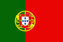
| Flag of Portugal | |
One of the oldest countries in Europe, its territory has been continuously settled, invaded and fought over since prehistoric times. The territory was first inhabited by pre-Roman and Celtic peoples who had contact with Phoenicians, ancient Greeks and Carthaginians. It was later ruled by the Romans, followed by the invasions of Germanic peoples and the Islamic invasion by the Moors, whose rule was eventually expelled during the Reconquista. Founded first as a county of the Kingdom of León in 868, gained its independence as the Kingdom of Portugal with the Treaty of Zamora in 1143.
Currency / Language
| ISO | Currency | Symbol | Significant figures |
|---|---|---|---|
| EUR | Euro | € | 2 |
| ISO | Language |
|---|---|
| PT | Portuguese language |


